There are 50 volcanoes in the Auckland volcanic region, the most recent eruption being around 600 years ago, when Rangitoto Island emerged from the sea. Rangitoto Island is Auckland’s only volcanic island, as well as its youngest, tallest and largest volcano, which officially gives it the title for ‘coolest volcano in town’. It’s 260 metres at its highest point, and its stretched out triangular shape looks the same from the mainland at almost any angle, making Rangitoto Island a classic Auckland icon.
Rangitoto Island is located 8km from Auckland, which, while that’s a terrifying thought when considering impending eruptions, is also great because it’s easily accessed by a ferry ride across the water of the Hauraki Gulf from town. Black, porous rock varying from little pebbles to boulders cover the beaches of the east coast, showing just how far the volcano’s lava fields reached.

How long is the ferry from Auckland to Rangitoto?
From the Ferry Terminal in downtown Auckland City, the Fullers ferry ride takes about half an hour to Rangitoto wharf across the generally calm sea of the Hauraki Gulf.
How much does it cost to go to Rangitoto Island?
It costs about $40 return on the ferry from Auckland city, and it’s a great way to discover the Waitemata Harbour and the other islands of the Hauraki Gulf: with the sun on your face and the ocean breeze in your hair.
Once you arrive, settle yourself in to island time, and head for the summit walk. The well formed track weaves through lava fields and native Pohutukawa trees to where you can peer over the edge of the cone at the top, and all around you for a panoramic view of the Waitemata Harbor. An island sanctuary, Rangitoto Island is actually home to a spectacular native Pohutukawa forest, the largest in the world.
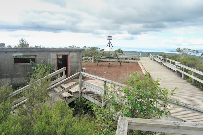
The summit track is one of Auckland’s most popular walks, and for good reason. 200 meters from the top is a side trip you’d be mad to miss: the Rangitoto Island lava caves. Explore the twisting tunnel hollowed out by lava – just follow the signposted Lava Caves Track for about 15 minutes.
The popular summit track is a short and easy climb, so for those are after a little more hiking action, hit some of the island’s longer walks. Discover the coast of Rangitoto on foot, walking around to where the shortest bridge in the world links it to Motutapu Island, or continue on from the summit to Islington Bay.
To link both, either walk from the summit or round the coast to Islington Bay, and from here cross the causeway to Motutapu Island. If you go all the way across to Home Bay, it’s about a 2 hour walk (one way).
As well as being Auckland’s youngest volcano, Rangitoto Island has its own colorful history. Māori, though they never lived there, used its summit as a surveillance post during wartime. When Europeans came along, they paid a whopping £15 for the rocky island, and it became available for public use. In the early 1900’s, prisoners built rock walls, roads and trails from the volcanic rock around the island, and the government sold a bunch of baches (Kiwi-speak for holiday homes) to help fund its development.
In the 30’s, land law changes put a stop to these little houses, and come WWII, Rangitoto Island once again became a surveillance zone. It was off limits and the summit was used as a base. Aside from one Japanese near-invasion, thankfully nothing much came of all that fuss. These days, as well as being home to the historic baches of the 20’s, Rangitoto Island is a conservation island, protected by the Department of Conservation.

Can you kayak to Rangitoto Island?
Kayaking out to a volcano that’s also an island, hanging out for sunset at the summit, and kayaking back by moonlight may just be the best thing you do in Auckland, and the coolest way to travel. The popular Sunset Tour starts from St Helier’s bay boat ramp in Auckland, and sets off in the fading light across the Waitemata Harbour toward Rangitoto Wharf. Upon arrival, dock your steed and scramble up to the summit to take in the views of the sun setting over Auckland city.
A side trip to the caves is a must, and remember to bring sunblock and a torch for these kayak tours. Next, clamber back aboard and paddle back towards the city, aglow with lights.
Can you swim on Rangitoto Island?
Most of the shoreline around the island (and especially where the ferry docks at Rangitoto Wharf) is rocky and volcanic, so it’s not the easiest access. But, if you explore further afield towards Islington Bay, there’s a sandy beach to two to cool off after a sweaty day exploring the island’s popular walks.
Or, if you’re looking for a little more action, join the annual Rangitoto Swim, and make the odyssey from Auckland. They swim every April, and you’ve got to have at least one 2.4km open water swim under your belt. Good luck.
When did Rangitoto Island last erupt?
600 years ago, which makes it just a little baby in volcano years. Experts actually think it was the only volcano in the field to have two separate eruptions.
Will Rangitoto erupt again?
Because of the two-eruptions thing, the volcano experts reckon it’s unlikely to erupt again.

Is Rangitoto safe?
From eruptions, we can’t say for sure, but your chances are good.
Can you stay on Rangitoto Island?
For the first time in over 100 years, you actually can, and you’ll get a taste for a typical New Zealand bach experience while you’re at it. There are a row of little baches along Islington bay, built mostly in the 1920’s, but since a land law change in the 30’s, these have been pretty much off limits.
Today, historic Bach 78 and Bach 114, both located in Islington Bay and with a view out to sea, are available to rent, and they’re both ridiculously quaint and will liven up your Auckland travel diary big time. Bach 38, meanwhile, has been turned into a historic museum. Even for those not planning to stay, it’s worth a wander to visit these little houses on a day trip – they’re a fascinating piece of New Zealand history.
If the historic bach you’re after is all booked out and you’re still hankering for an island escape, Waiheke Island is about 40 minutes on the ferry from downtown Auckland, and another of the gorgeous islands of Auckland to explore.
Waiheke is far bigger than Rangitoto, and has a permanent population and its own thriving scene, with accommodation, food, golden sand beaches and a bunch of wineries to boot.
What animals live on Rangitoto?
Thanks to the hard work of the Department of Conservation, Motutapu Island and Rangitoto Island are both pest free. For a quick New Zealand history lesson, the country is home to some of the world’s most unique birdlife. Because the wee island nation developed so far from the rest of the world, and therefore from any bird-eating predators, these spectacular native birds evolved to be flightless and more or less defenseless.
Enter Europeans to the shores of New Zealand, who both deliberately and unwittingly introduced pest species like possums, stoats and rabbits to the mainland(s) and the islands.
Turns out these guys love to eat native birds and their eggs, and eradicating them is one of the main missions for the Department of Conservation (and many passionate Kiwis – the people, not the birds). The volcanic soils of Rangitoto Island make for a thriving flora population, too, with moss, plants and trees covering the island, and the largest Pohutukawa forest in the world.
Does anyone live on Rangitoto Island?
Nobody lives on Rangitoto Island, Auckland, but there are plenty of folks who know it like the backs of their hands. These tend to be the conservation workers or guides, and are the best people to have around to take you on a day tour.
How hard is the Rangitoto walk?
Walking from Rangitoto Wharf, it’s about a half hour gentle climb up to the crater. The view from the top is well worth it; across Auckland city, out to Waiheke, Tiritiri Matangi and Motutapu island, amongst the countless other islands scattered across the Hauraki Gulf. Remember to tack on a trip to the lava caves, too, which are just next to the summit.
We’re not talking about extreme hiking, here, but it can get hot, so make sure to bring water, sunblock and a torch if you’re heading into the lava caves. Explore the volcano on your own self-guided tour, or take one of the guided tours on offer, like the Rangitoto Island Explorer.
The quick ferry ride, easy walking and spectacular views make Rangitoto a perfect half day trip from Auckland’s CBD. Or, bring a picnic and make it a full day mission, or even better, kayak back by moonlight.
So there you have it – another very cool, volcanic reason to add Auckland, New Zealand to the top of your travel list. See you there.