

Tide's Out Maps
Coromandel Peninsula II
Coromandel Peninsula II
Regular price
649 NZD
Regular price
Sale price
649 NZD
Unit price
per
Shipping calculated at checkout.
Couldn't load pickup availability
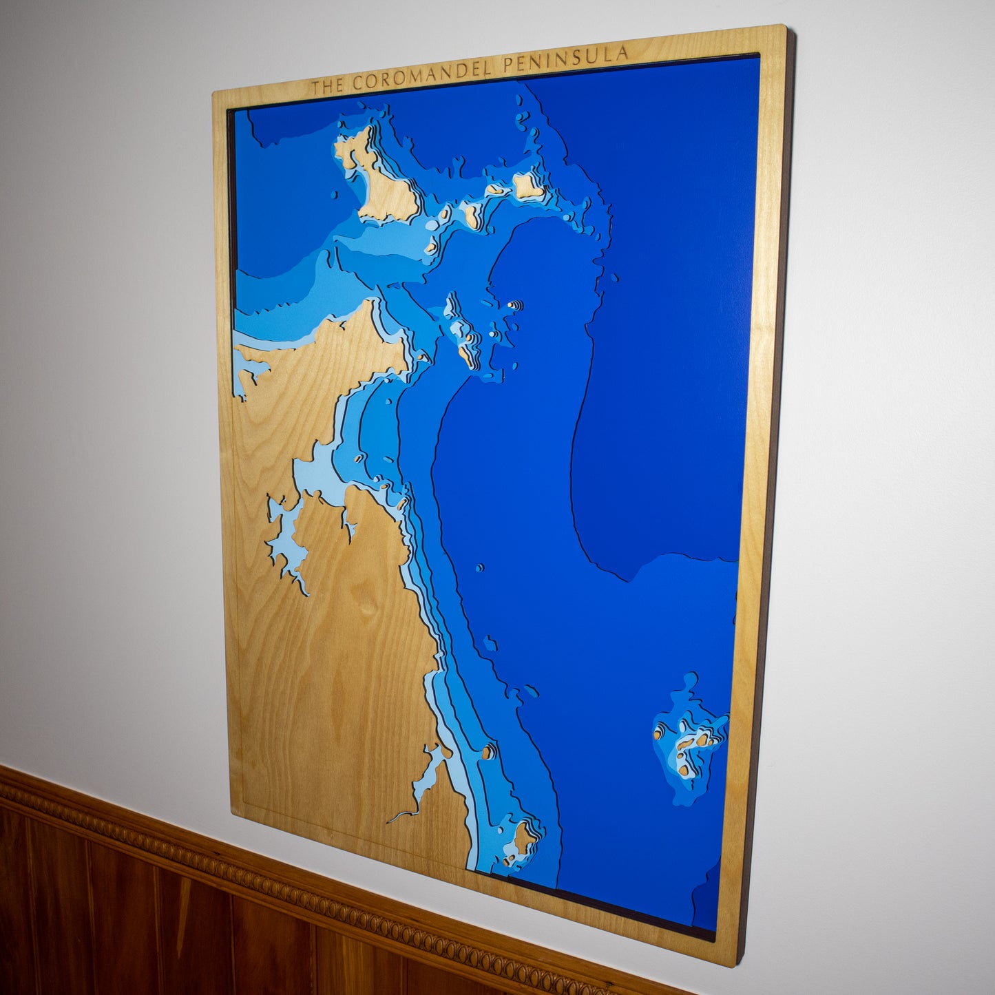
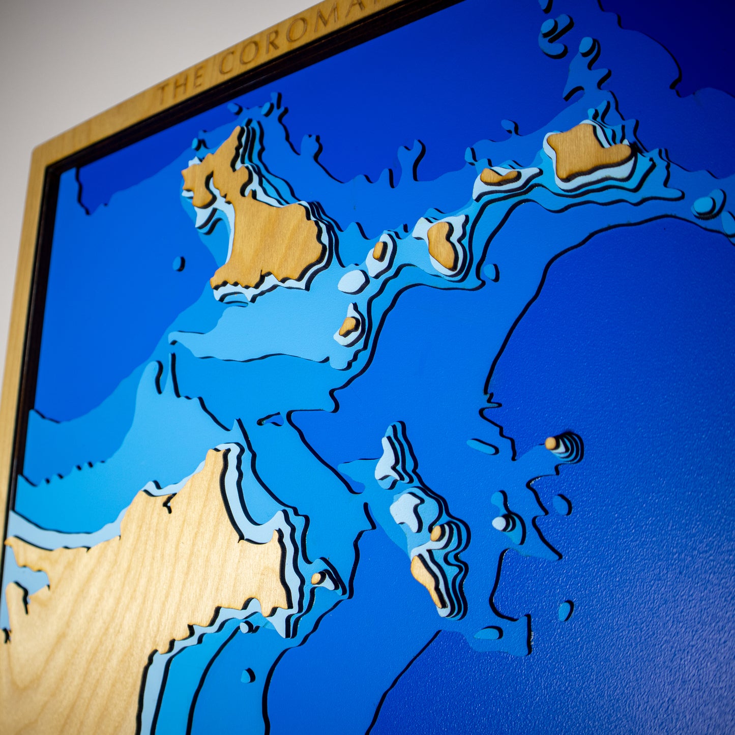
This is our wooden depth map of the Coromandel Peninsula.
.
The Coromandel Peninsula is located on the east coast of the north island, and is home is some spectacular islands and coastlines. The Mercury islands can be seen in the north, consisting of the larger Great Mercury island, Red Mercury to the east, and 5 small islands. Great Mercury is thought to be the first land mass that the Maori settlers saw when approaching NZ. Sitting about 20km off the coast of Tairua, the rugged Alderman islands are a nature reserve, and offer incredible diving and fishing.
.
We design and build all our maps right here in New Zealand. To make geography accurate, each layer is laser cut. We then paint and assemble them by hand. Find out more about our maps, bespoke addition, and how they're made.
.
Size: 590 x 790 mm, Plywood: European Birch 3-ply
Layers: Sea level, -10m, -20m, -30m, -50m, -100m, -200m.
.
If you'd like to add any personal touches to your map, please add a note to your order and we'll be in touch.
.
Note - All of our maps are made to order, and can take up to two weeks to build.