The Waikato region lies immediately to the south of Auckland and stretches from the east to west coasts. It features widely varied landscapes that range from the Coromandel Peninsular with its idyllic sheltered beaches, through extensive rolling farmland and rugged hill country to the exposed surf beaches of its west coast, while the region’s southern extremity encroaches onto the volcanic Central Plateau. Hamilton City is home to splendid public gardens and an important agricultural university, while the wider region boasts New Zealand’s longest river, largest lake and some of the country’s most popular visitor attractions at the Waitomo Caves and Hobbiton. The oceanic climate provides average daytime temperatures ranging from nine degrees in winter months to 19 degrees in the summer. Overnight frosts during winter regularly fall several degrees below zero and warm days in the summer can see temperatures of around 30 degrees. A combination of fertile soils, high sunshine hours and regular rainfall ensures that grass growth can exceed one centimetre per day. With around 1.7 million cows milked on 4000 mostly family owned farms and producing as much as 30 million litres of milk daily during peak season, the Waikato accounts for around 33% of New Zealand’s dairy industry. The region also supports sheep and cattle farming and a significant thoroughbred horse industry. Not surprisingly, the lush pastureland and plentiful attractions provide a thoroughly enjoyable experience for those wandering through on self-drive holidays.
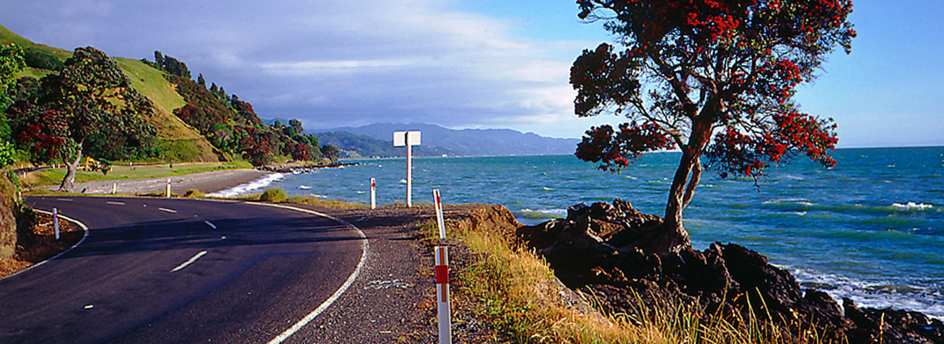
The 85 km long Coromandel Peninsula stretches out into the Pacific Ocean to the east of Auckland and forms the northern-most part of the Waikato region. It takes its name from a vessel of the Royal Navy that called in 1820 – itself named after a coastline in India. Between the peninsula’s west coast and the Auckland region lies the Firth of Thames, while its northern reaches form a boundary of the Hauraki Gulf. The interior is occupied by the rugged Coromandel Range that rises to nearly 900 m in places and results in almost the entire population of 29,000 living in small settlements around the coast. The gateway town of Thames was once a thriving centre with three times the current population of 6000 people after gold was found in the area in 1867 – making it the largest town in the country for a while. The local Resident Magistrate, one Harry Kenrick was none other than the great great grandfather of the founder of New Zealand Frontiers and scribe of this article. He had emigrated from Wales in 1861, at a time when the European population of New Zealand was little more than one hundred thousand people, and his resting place remains some distance below the daisies and a headstone bearing his name in the Thames cemetery. The goldfields he presided over gave up over two million ounces during their heyday, and mining continues to the southeast at Waihi. In addition to fine hiking and mountain bike trails in the dense forests that cover much of the area, the peninsular is famed for its abundance of picturesque beaches, particularly on the Pacific coast. The Coromandel remains popular with the alternative lifestylers it became synonymous with during the 1960s and 70s, but these days also hosts many holiday homes for Aucklanders in places like Pauanui. An enduring feature of the area are its plentiful galleries operated by artists who revel in the slower pace of life. For those travelling at a leisurely pace by motorhome, the drive to the northernmost tip of the peninsular is well worth the effort, though the seemingly complete absence of straight roads enforces the unhurried progress favoured by most locals. The region is well worth including even on shorter itineraries, with a convenient circuit of SH25 taking you half way up the peninsular and providing access to many of the Coromandel’s gems such as Hot Water Beach and Cathedral Cove.
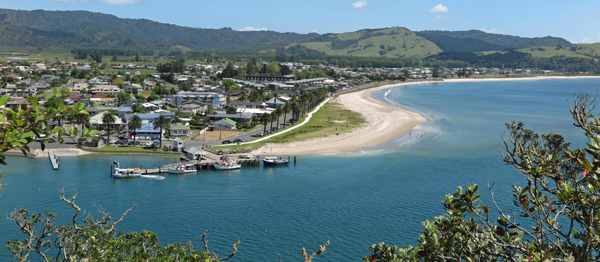
Whitianga’s population of 5000 makes it the second largest town on the Coromandel Peninsular after Thames. It is situated in Mercury Bay which was named by Captain James Cook who observed the transit of Mercury during his visit to the local waters in 1769. The useful harbour promoted settlement and was an export point for Kauri logs to the world, an important industry throughout the upper North Island in early European times. Diving and fishing (including for big game fish) is available from friendly operators around the town’s port. Nearby Cook’s Beach is reached either by a short ferry ride or a longer drive and rates as a real gem with features including a choice of holiday parks.
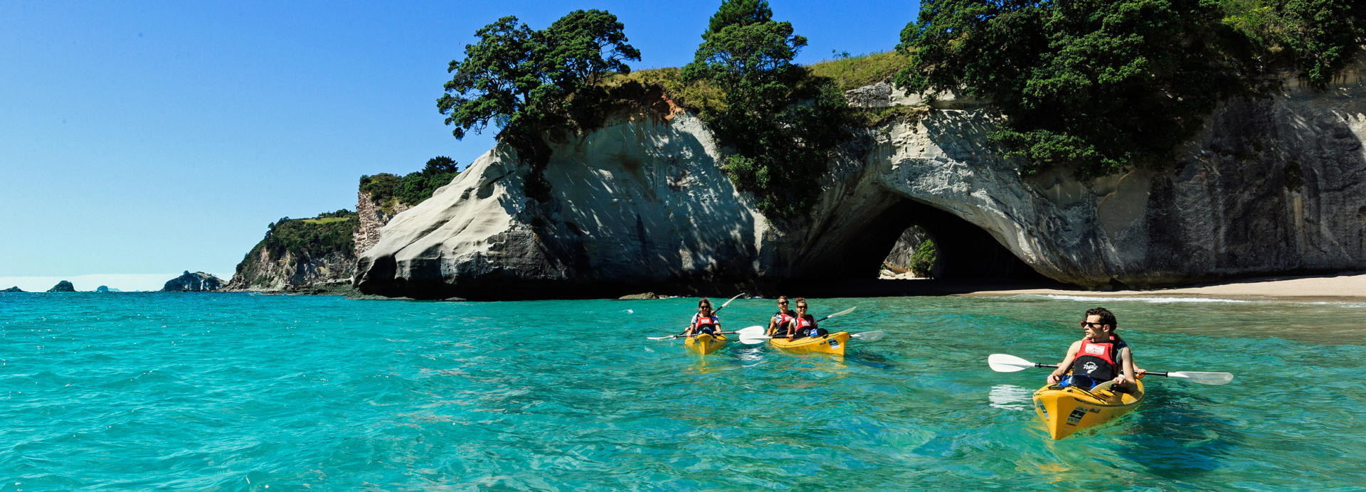
Cathedral Cove on the Coromandel Peninsular features a spectacular rock arch that makes it one of New Zealand’s most photographed beaches. It is reached via an easy hour-long walk or a pleasant paddle by kayak from the nearby seaside settlement of Hahei. With the adjacent marine environment protected as a reserve and the coastal hike often very popular during summer months, the kayaking option can be a good choice. Hahei features a holiday park and makes for a thoroughly enjoyable overnighting opportunity. A hilltop pa site (location of a former fortified village) is accessible from the beach at Hahei, and a local craft brewery and restaurant welcomes visitors to Narnia, in reference to the scenes for the movie of the same name that were shot on the local beaches.
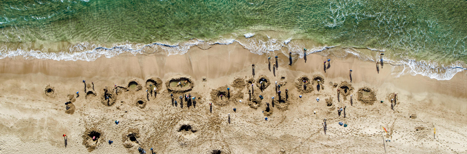
New Zealand features literally dozens of natural hot springs from close to the top of the country to the deep south, from alpine locations to beaches where you can watch the sun rise from the Pacific horizon or set into the Tasman Sea. Few are as famous as Hot Water Beach on the Coromandel Peninsular. Although its reputation doesn’t guarantee a peaceful experience, the accessibility and curious opportunity to sit in a hot pool while having the waves of the ocean roll over you is a memorable one. The thermally active area is only exposed at low tide but rewards those who dig themselves a pool with waters of up to 64 degrees. Spades can be hired and a holiday park encourages lingering in this idyllic area.
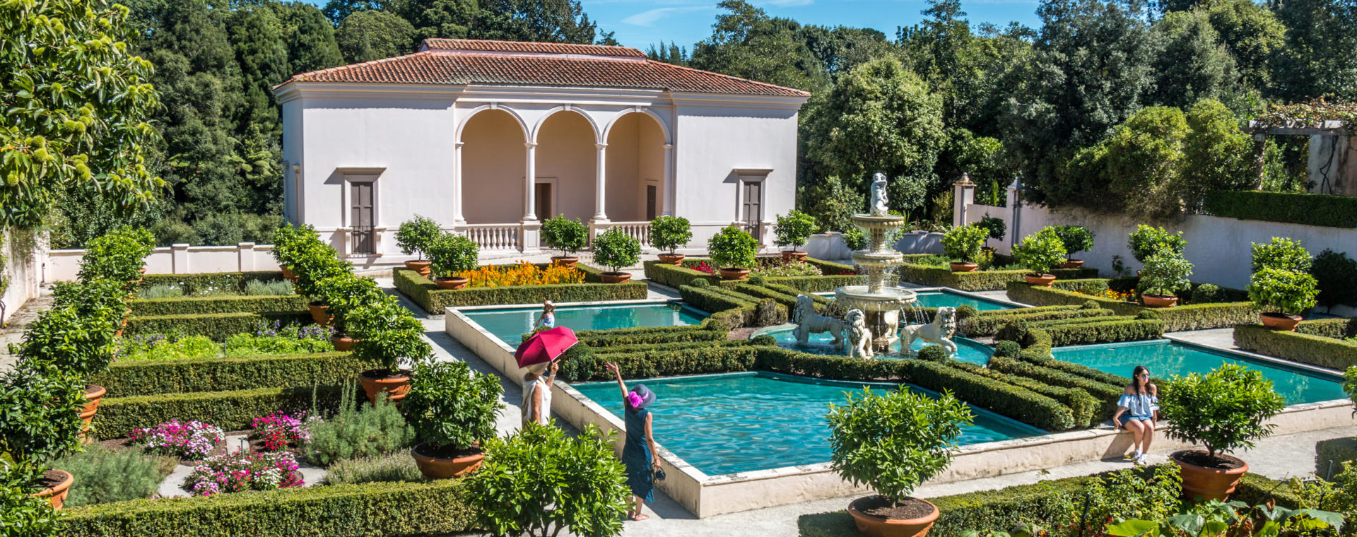
Hamilton is New Zealand’s fourth most populous city and is situated on the banks of the Waikato River, from which the wider region takes its name. The city is a pleasant one to visit with a thriving dining district, and further cafes located at the peaceful Hamilton Lake (Rotoroa) and the superb Hamilton Gardens. The climate provides high sunshine hours, enjoyably warm summers and often crisp, clear winter days after brisk overnight frosts. One of the country’s major hot air balloon festivals is hosted during April, and in June one of the world’s largest agricultural field days is held at Mystery Creek, during which around 1000 exhibitors achieve $500 million in sales. The city is also home to Waikato University with over 10,000 students and the world-class AgResearch Institute. Once an agriculturally based economy and remaining home to a major Fonterra milk powder factory and Gallaghers, a leading manufacturer of electric fences, local industry is now more varied and includes Pacific Aerospace who have manufactured over 1000 agricultural, skydiving and basic military training aircraft. The neighbouring town of Cambridge is located a short distance upstream on the Waikato River and is known for its picturesque streets, particularly colourful during autumn. Further upstream a lake formed by the Karapiro hydro power station dam has rowing facilities that have hosted major international events and ensures that Cambridge is the hometown of several world champions. To the southwest of Hamilton, on SH3, is Te Awamutu which is known for its rose gardens and as being the hometown of Tim and Neil Finn, whose bands Split Enz and Crowded House had hits with songs that include the town’s name.
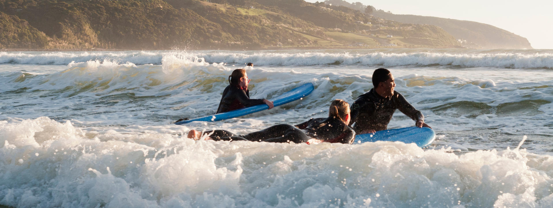
Raglan is best known among locals as having one of New Zealand’s finest surf beaches. With a population of a little over 3000, it also makes a nice relaxing place to check out small town Aotearoa and to experience the wild iron sand beaches of this stretch of the Waikato’s west coast. The town is large enough to support a holiday park and cafes and has safe swimming in the harbour. A local airstrip is a popular destination for light aircraft pilots from Auckland who come down for a coffee when the weather beckons. For those who are into surfing, boards can be hired and friendly advice received on the four local left hand breaks reputed to be among the longest in the world. The Manu Point break featured in the seminal 1966 surf movie ‘The Endless Summer’. Raglan is reached via an easy 50 km drive along SH23 from Hamilton. Better still is the opportunity to travel to or from Waitomo via scenic back roads that pass by Marokopa and Bridal Veil waterfalls, along with the smaller settlement of Kawhia that has lesser known thermal springs on a nearby beach.
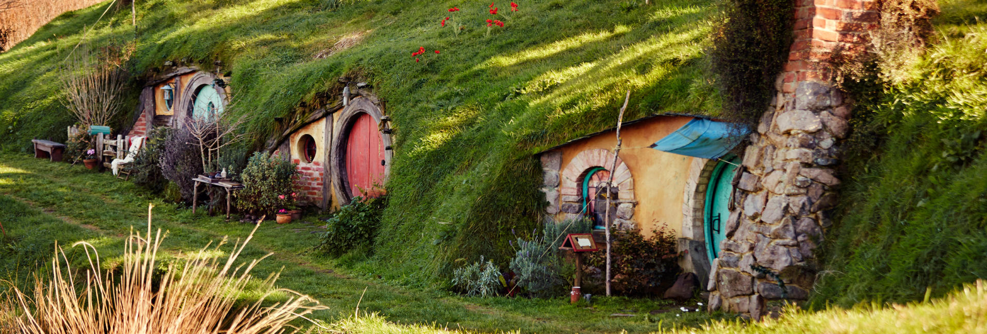
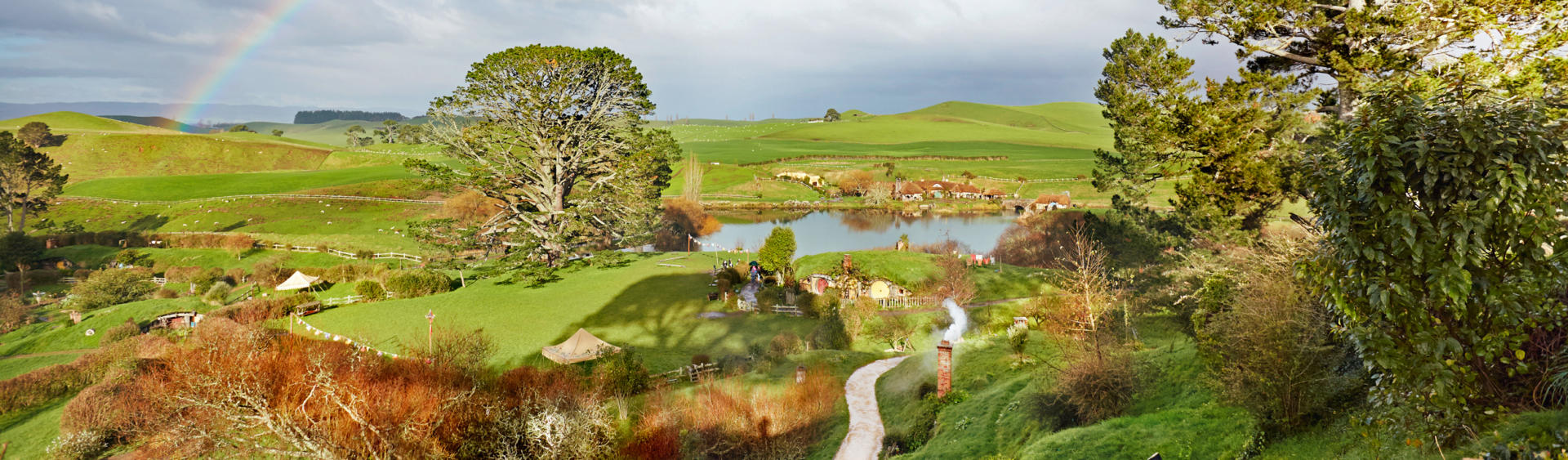
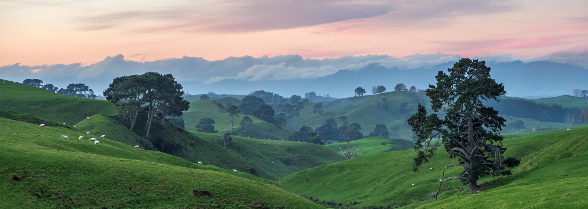
Hobbiton is one of the key movie sets created for the Lord of the Rings trilogy of movies that were filmed throughout New Zealand over the period 1999-2000 at a cost of USD$281 million. Prior to filming, local director Peter Jackson spent much time searching the entire country with location scouts and identified the site for Hobbiton during an aerial survey. The set occupies about 1% of a 500 Ha privately owned farm that continues to stock up to 13,000 sheep and several hundred cattle. Construction of a set capable of hosting up to 400 cast and crew daily was no small task and the New Zealand Army assisted with building roads while contractors created 37 hobbit holes, gardens, the double arched bridge and a 26 ton oak tree cloaked in thousands of silk leaves that were made in Taiwan. As construction was completed to temporary standards, the set has received significant rebuilding along with the addition of further hobbit holes and the Green Dragon Inn that featured as a fictional place in Tolkien’s tales. The site was chosen for its beauty and the surrounding countryside is lush and highly photogenic, ensuring Hobbiton’s place as one of New Zealand’s most popular attractions.
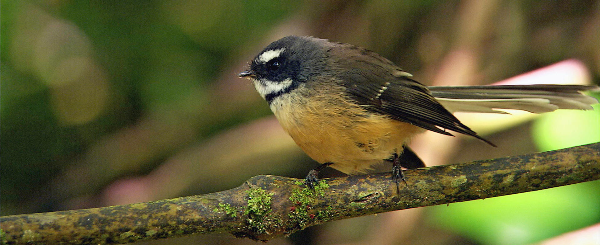
Maungatautari – Sanctuary Mountain is located a short drive from SH1, 60 km south of Hamilton. It represents a wonderful opportunity to see some of New Zealand’s rarest bird species in their natural habitat. Guided daytime, dusk and night-time tours are available by prior arrangement, with all admission fees directly supporting the charitable trust that oversees conservation work. New Zealand is recognised as a country where isolation from the rest of the world and an absence of animal species led to a unique birdlife with an unusual number of flightless species. Many were hunted to extinction as a food source by the Maori population and others were decimated by the predatory species subsequently introduced by Europeans, or by the habitat loss incurred as the near universal forest cover was cleared for farming activities. Maungatautari doesn’t just represent a remaining area of untouched native forest, but one which has had a 43 km predator proof fence built around it. Successful predator eradication from within the sanctuary has created an environment where one can witness the former splendour of our land. Birds often able to be viewed include kiwi, kaka (a large bush parrot), kokako and tieke (both wattlebirds), hihi (a small stitchbird) tui and korimako (large honeyeaters), piwakwaka (a small fantail), kereru (a large bush pigeon), takahe (a large flightless alpine hen) and pukeko (large swamp hens). There are also opportunities to see the fascinating ancient tuatara (a reptile).
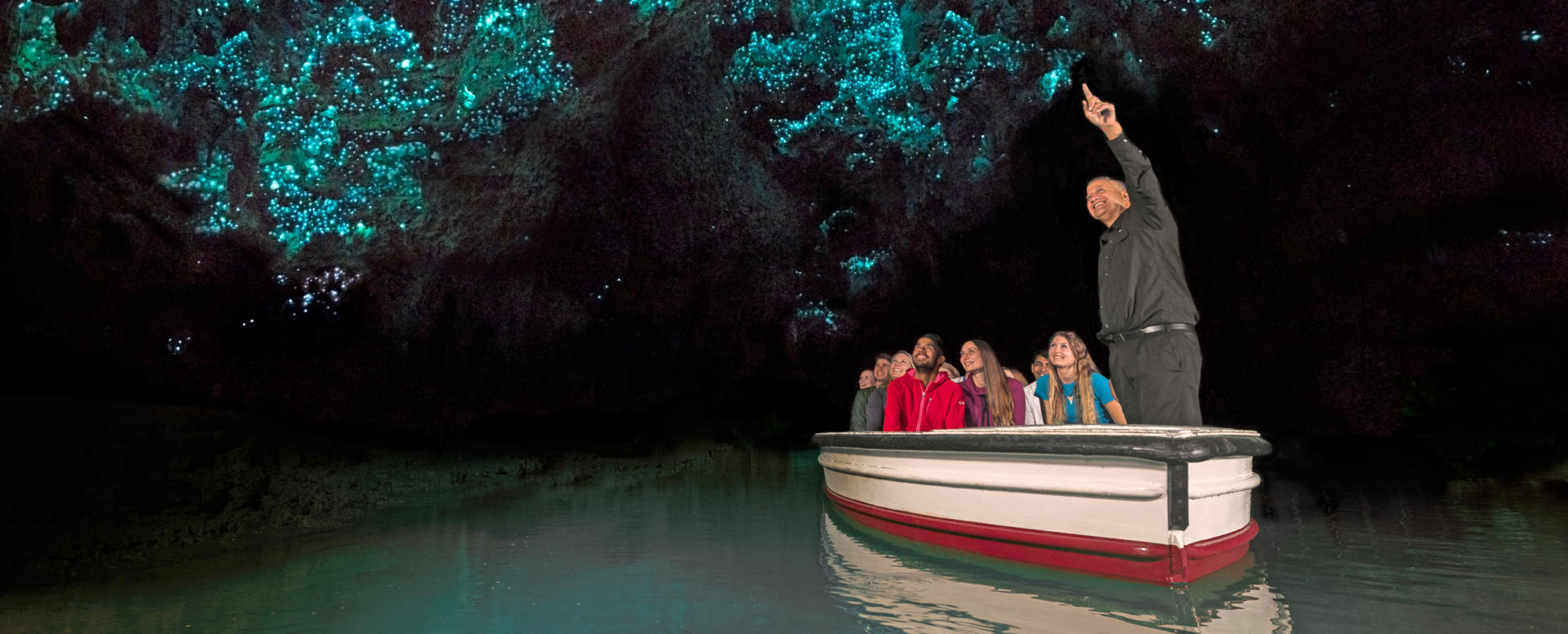
The name Waitomo provides more than a hint to the locality’s abundant limestone caves through which streams pass. Of the roughly 300 known caves, several are accessible to the public via guided tours. The largest of these, the Aranui cave features a steam large enough to be negotiated by boat and the experience of gliding silently through impressive stalactites and stalagmites beneath a roof covered in sparkling glow worms is special indeed. For those blessed with more nimble knees, other tours are available that include abseiling into giant sink holes and black water rafting through more turbulent and claustrophobic cave networks. The district’s attractions have long been recognised, with the government establishing a hotel in Waitomo village as early as 1908 and which remains to this day, along with a more modern holiday park and other accommodation options. Waitomo Village is a well sign-posted eight kilometre side trip from SH3 and lies in rolling hill country featuring the region’s predominant family owned dairy farms. Beyond the caves the road continues onward to eventually reach the west coast, with hiking opportunities and the Marokopa Falls to visit along the way. One can also continue northwards along unhurried back roads and past the extensive Kawhia and Aotea harbours to eventually reach the popular surf town of Raglan. If returning to SH3, the rural service town of Otorohanga lies a short distance northwards and features a kiwi and native bird conservation facility with the country’s largest aviary. To the immediate south on SH3 is the service centre of Te Kuiti, known locally and among the sport shearing community globally as the sheep shearing capital of the world.
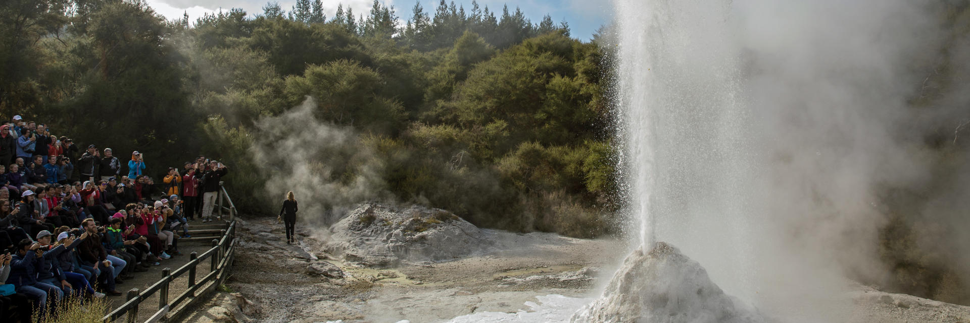
Wai-o-tapu (meaning sacred waters) is one of the Taupo Volcanic Zones most impressive active thermal areas. The wonderland of stunning geothermal activity on display is represented by names given to features in the park such as the Champagne Pool, the Artist’s Palette and Primrose Terrace. The Lady Knox Geyser is tempted into action at 10:15 each morning through the application of a surfactant and plays to a height of 20 m for up to half an hour. The park is located a short drive from SH5 between Rotorua and Taupo and was famously discovered by Europeans in 1901 when prisoners from a nearby camp observed that the soap they used when washing clothes in hot springs at the site prompted the eruption of a geyser. A further thermal park nearby at Waimangu was famous for a geyser that erupted regularly for hours at a time to a height of 460 m from 1900 to 1904.
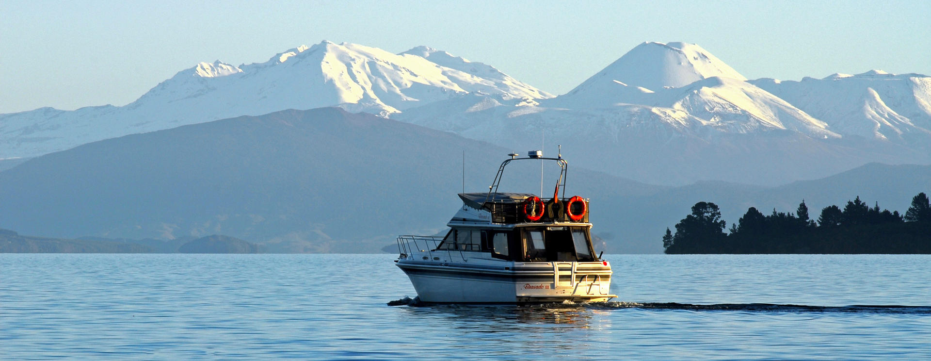
Taupo is widely favoured as a holiday destination among New Zealanders thanks to its lakeside location, spectacular views southwards to the volcanoes of the Central Plateau, and the multitude of activities nearby. The town is located on SH1, the main highway that runs the full length of the country, and is 278 km south of Auckland. It is the Waikato region’s second largest town. In addition to the significant tourism industry, Taupo is also an important service town for the forestry and farming industries that surround it. Several neighbouring geothermal power stations generate about 15% of national electricity requirements – the highest geothermal contribution to the energy needs of any country in the world. Lake Taupo drains into the Waikato River (the country’s longest at 425 km) near the town centre and several of the river’s hydro-electric power stations also lie nearby. Taupo’s elevation of 360 m ensures that temperatures are rarely uncomfortably hot and overnight frosts during the winter months can be severe. The lake’s 616 sq km area and almost 200 km shoreline make it the largest in New Zealand. It was formed by a series of phenomenal eruptions (some of more than 100 cubic kilometres) that have occurred roughly every thousand years for the last 28,000 years. Rocks the size of cars have been found as far away as the Bay of Islands from Lake Taupo and the lake continues to have hot springs at its deepest point. In clear weather the 80 km distant mountains of the Tongariro National Park make a particularly photogenic scene across the lake from the viewpoint behind the town centre or from the lake front path. The spectacular Huka Falls, a short drive north of town on the upper reaches of the Waikato River are a scenic gem formed where the river passes through a narrow canyon. A myriad of other attractions encourage visitors to linger, including world class golf courses at Wairakei and Kinloch, superb mountain biking trails, hiking to the summit of nearby Mt Tauhara, bungy jumping, sky diving, jet boating and relaxing thermal pools in which to contemplate all the scenery and excitement.
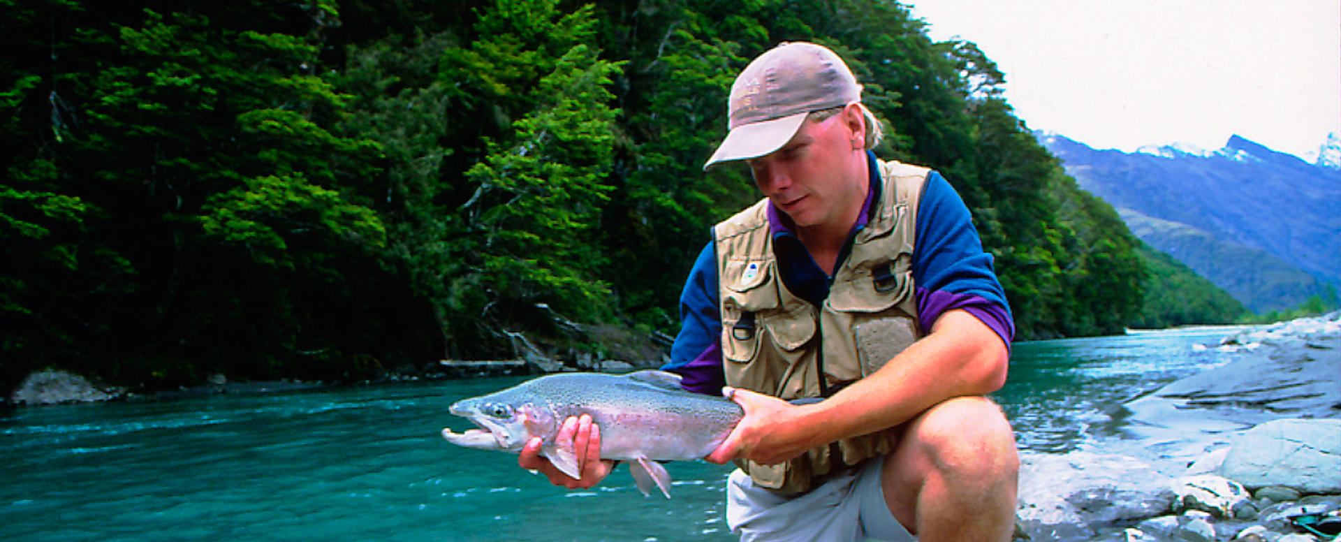
Turangi is lies on the southern shores of Lake Taupo at a point half way between Auckland and Wellington on SH1. The township is home to the mouth of the Tongariro River which has long been famed as one of the finest trout fishing rivers in the world. The local population received a major boost from around 500 to 6000 in the 1960s when it was developed as a worker’s town in support of the neighbouring Tongariro hydroelectric power scheme that involved the construction of an extensive network of tunnels, canals and power stations. These days the town has an established population of approximately 3000 people and serves as a gateway to the hiking trails and ski fields of the Tongariro National Park. Fishing licences can be purchased, excellent white water rafting trips are available, and thermal pools are located nearby at Tokaanu. The 5 km trail around Lake Rotopounamu on Mt Pihanga is a superb easy walk accessible from the SH47 route to the Tongariro National Park headquarters at Whakapapa. To the south SH1 also enters the National Park and eventually passes through the Rangipo Desert where the road rises to its highest point (1074 m) on its journey from the top of the North Island to the bottom of the South Island.