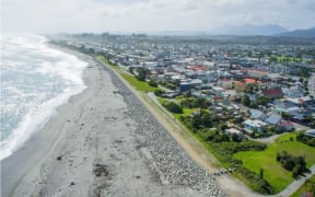
The Greymouth Floodwall which protects the CBD to the left of the picture was built following two record floods in 1988 which almost forced the town to be moved. Plans are in train through Government co-funding with the West Coast Regional Council to raise and strengthen the current floodwall. Photo: Brendon McMahon / Greymouth Star
Greymouth Joint Floodwall Committee members fear dire coastal hazard mapping done for the Te Tai o Poutini Plan could hinder land and building development in the area.
The recently revised maps by Niwa using Lidar technology, come as the Greymouth CBD redevelopment forges ahead.
The new modelling, provided for the West Coast Regional Council, covers the entire coastline from Hector to Jackson Bay.

Comparison of TTPP Coastal Hazard Overlays (blue hash) with the Updated NIWA Inundation Modelling in red covering the Greymouth CBD. Photo: West Coast Regional Council / Te Tai o Poutini Plan
It shows the sea inundation risk at Cobden and other parts of coastal Greymouth is far worse than the current hazard map zones included in the TTPP when it was publicly notified last year.
The TTPP committee has already agreed to seek a 'variation' to incorporate the new maps in the plan.
TTPP acting project manager Rachel Vaughan told the floodwall committee meeting on Thursday the change for Cobden, in particular, were "substantial".
"It definitely has implications for both the Cobden and Blaketown areas."
Greymouth Mayor Tania Gibson said her council had "big concerns" around the implications for town development.
"In the TTPP, these maps don't take into account our flood protection."
If the new Lidar modelling did not recognise the floodwall scheme, or the planned improvements to it, it would cast a shadow over the development of the CBD, Gibson said.
Vaughan the modelling looked at coastal inundation and for a 100-year return flood, where there was a risk of overtopping which could lead to the failure of the walls.
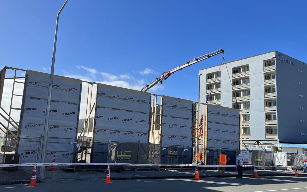
Redevelopment of the Greymouth CBD has seriously advanced in the past year based on plans to further improve flood protection for the area. The development pictured on Mackay Street is by Mawhera Inc and is the site of the former Broadcasting House which is being rebuilt as a new retail space. Photo: Brendon McMahon / Greymouth Star
West Coast Regional Council deputy chairman Brett Cummings said: "I would have thought that was why we built the floodwall here -- to protect this area."
Regional council chairman Peter Haddock said they did not want to put off people investing in the area.
"The only time it would be a risk would be if there was a flood in the river and there was a sea level rise (at the same time)."
Vaughan said coastal inundation "by itself" would move up the river.
"It doesn't take into account a peak flood flow."
Grey District Council member Allan Gibson said in that case, "we might as well move the town now".
Vaughan said the new information was about assessed "acceptable risk" for consenting around land development.
"This is a flag to the planners that more investigation needs to be done.
"That would mean that the planners would have to work with the applicant to assess the risk and then the resource consent would have to assess the level of risk was acceptable."
She did not believe it would automatically stymie development, "but flag" risk.
Former regional council chairman Allan Birchfield said the concept of accounting for sea level rise "is a fraud".
Vaughan said the new Lidar information was "not the end, just the beginning" of a process.
Local Democracy Reporting is Public Interest Journalism funded through NZ On Air
![NZ Defence Force/supplied
[57] An aerial view of the eastern end of Westport during the July 2021 flood.](https://media.rnztools.nz/rnz/image/upload/s--BS6Ege2I--/ar_16:10,c_fill,f_auto,g_auto,q_auto,w_288/v1676944005/4LD8J25_20210718_NZDF_P1024180_057_2_scaled_jpg)